Category 4 Hurricane Erin churns off East Coast
An image provided by the National Weather Service shows Hurricane Erin on Monday. Associated Press / Photo by NOAA
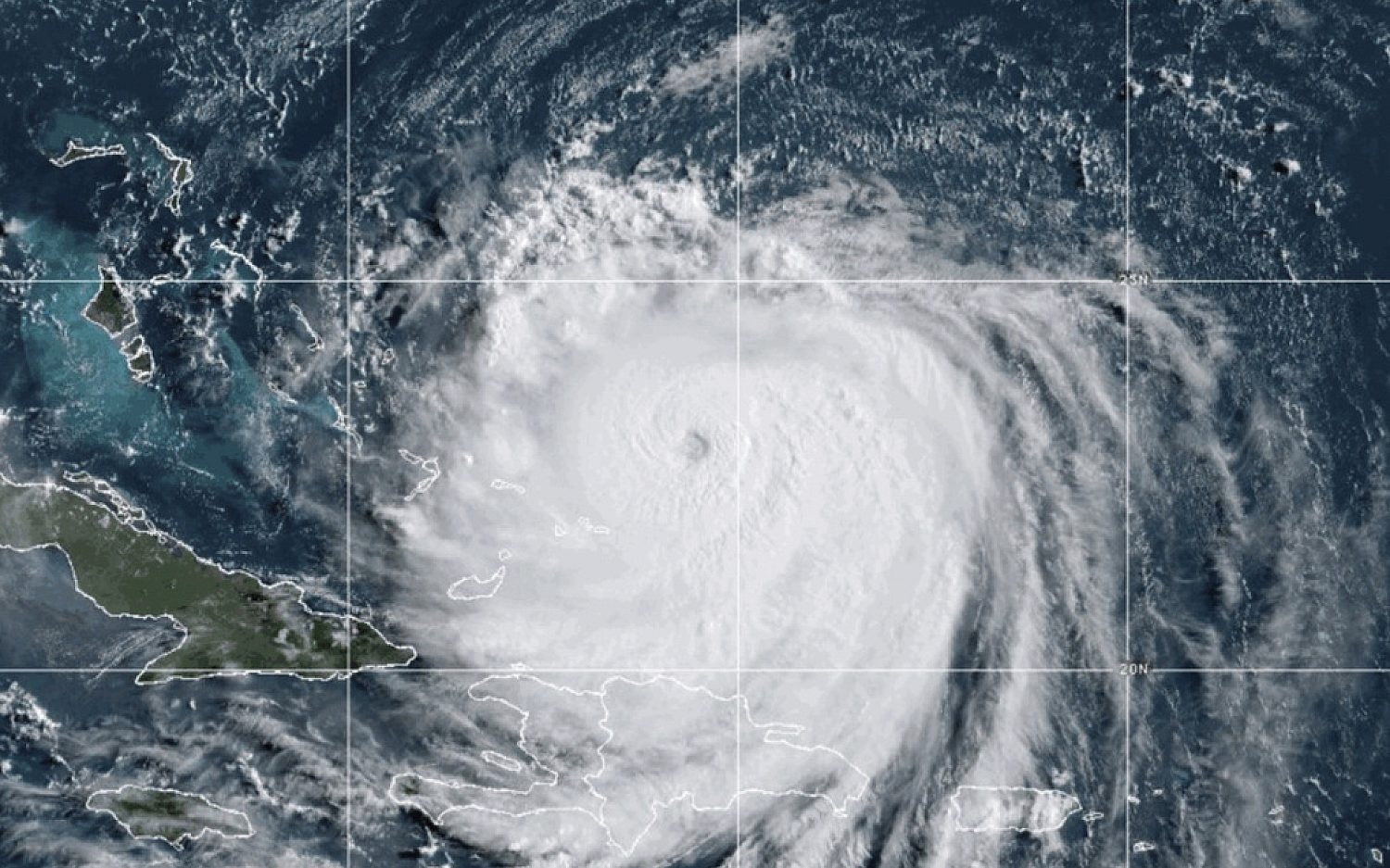
The National Hurricane Center on Monday said the hurricane was expected to bring strong winds, life-threatening waves, and rip currents to the Eastern Seaboard throughout the following week. Erin began as a tropical storm last week and gained strength as it crossed the Atlantic Ocean. It briefly became a Category 5 hurricane Saturday before weakening Sunday. Erin became one of the most quickly intensifying Atlantic storms in history after going from a Category 1 to a Category 5 within one day. By Monday morning, it had sustained winds near 130 mph, and forecasters said it would likely remain large and dangerous for several days. With more than 100 days until the end of hurricane season, Erin is still considered an early-season storm.
How are communities in Erin’s path responding? The storm on Monday lashed Puerto Rico with heavy rain and damaging winds. Officials warned people not to visit beaches along the island’s south coast due to rip current risks. The U.S. Army Corps of Engineers staged flood relief in the U.S. Virgin Islands to respond to the hurricane’s effects. In North Carolina, Dare County issued an evacuation order for Hatteras Island on Monday.
Dig deeper: Read Travis Kircher’s original report about the hurricane last week.


An actual newsletter worth subscribing to instead of just a collection of links. —Adam
Sign up to receive The Sift email newsletter each weekday morning for the latest headlines from WORLD’s breaking news team.


Please wait while we load the latest comments...
Comments
Please register, subscribe, or log in to comment on this article.